Posts

Showing posts from March, 2012

Google Ads

Moongate to 84 via pondan trek and Cendana hill

Image
Penang Hiking Trails : From Moongate to 84 via Bukit (hill) Cendana peak This hiking trail is one of the toughest hiking trails from Moongate to 84 rest area. Be well prepared for this hiking trail. However, you don't have to bring plenty of water with you as you can get refreshment from point 5 rest area midway through.

Cherok Tokun, Bukit Mertajam Hill

Image
Penang Hiking Trails : From Cherok Tokun to Bukit (hill) Mertajam peak This hiking trail starts from the car park near the water cachement area of Cherok Tokun at Bukit Mertajam, Penang . This place is also known as BM Hill. There are many hiking trails around this hill. This hiking trail is considered the among toughest hiking trails at the hill. Coming down the hill, you will take the tarred road from the telecommunication towers and midway through you will take the jungle trail back to the car park where you started the hike. 

FBReader for Symbian

Image
FBReader is a free and open source eBook reader application. It supports ePub, FB2, HTML, plucker, PalmDoc, zTxt, TCR, CHM, RTF, OEB, plain text and non-DRM mobi formats  [2] . Currently this application is still in Beta  [1]  state but it's a usable application for your daily read. Compare to Albite Reader, FBReader supports more than just ePub format. You can flip pages using the volume keys and it has a better eBook collection library.

Best Screensnap

Image
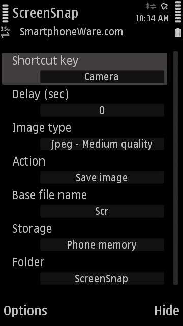
Freeware application that allows you to capture screenshots on your smartphone and save them to a file or send them to friends or to your desktop computer.

GPX Editor

Image
This is a nifty piece of software that enables you to edit your GPX track logs. It's light, standalone and very easy to use for editing your GPX track log file.  I used Sports Tracker or ViewRanger to track my hiking trails and usually the track logs will have some erratic points due to stationary position and some spikes due to inaccuracy of the GPS reading. Using GPX Editor enables me to clean up the tracks pretty fast and efficiently. This software is still under rapid development and expect some hiccups from the software but overall it's usable for my needs. Unfortunately GPX Editor only runs on Windows platform, however i have tested it to run under Wine for my Ubuntu Linux platform and it runs and performs most of the functions but the map background overlay does not work from the software. You will have to open the html file created at the same folder to view it in your web browser. These are some of the nice features GPX Editor has to offer:

The Star Online

Official app for Nokia Symbian^3 smartphones by The Star, Malaysia's top English news publication

Air Itam Dam to Tiger Hill

Image
This is a tough hiking trail. Please be well prepared for this hiking trail. Bring enough water and food as there will not be any rest stops that provides snacks and water supply like other hiking trails nearby Penang Botanical Gardens. This hiking trail starts from Air Itam dam and head to the peak of Tiger hill. From the peak take the left branch going down the hill and make a big round of the hill to Western Hill then back to the peak of Tiger Hill. You will pass through some farms. From the Tiger Hill peak, you head back to Air Itam dam.